The Routeburn Track New Zealand is one of the most popular Great Walks of New Zealand, and for good reason. Not only does it offer breathtaking vistas, mountain passes and a huge variety of lush forests, waterfalls, bridges and lakes, but it is very accessible with extremely well formed and maintained trails. Therefore it appeals to a wide variety of hikers and it is very busy. As such you’ll rarely feel like you’re off the beaten path on the Routeburn but the views well and truly make up for that.
With a range of options from camping, extremely high quality “huts” and guided private group lodges, people come from all over the would to hike the Routeburn Track. It can be travelled in either direction (north to south or south to north) with the majority of tours travelling south to north.
With one night to spare before flying back to Australia, we hadn’t planned on another hike following 4 days hiking the Gillespie Pass Circuit in the Mount Aspiring National Park, and 2 days in Queenstown but as a last minute decision we hit the road.
Hiking the Routeburn Track is usually completed as a two or three day trip (but sometimes done in one) and is a point to point trek, however we decided on an in and out hike from the Routeburn tracks northern point (near Glenorchy) to the Track’s highest point of Conical Pass, camping overnight in the tent, with a quick hike out back to the car the next day and on to the Queenstown airport. Sometimes, the plans on the fly end up working out best and we really scored some amazing weather and a quick adventure which sealed off a magic week of hiking in New Zealand.
The Key Details
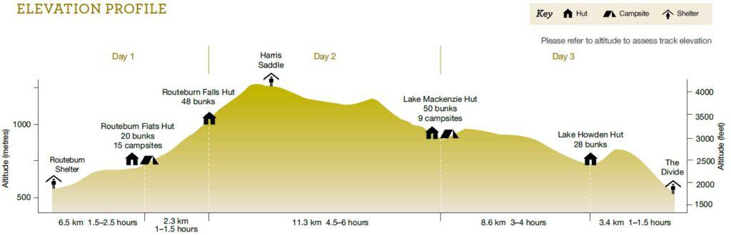
Distance: Approximately 25km return (our in and out route). If you do the whole point to point length of the Routeburn track it is 33km
Duration: 1 day / overnight with short 2 hour walk back to car on 2nd day
Start / Finish: point to point (we hiked in and out to same point)
Direction of Travel: We started from the northern point. If completing the entire length of the Routeburn Track it can be done in either direction
Elevation Gain: 1,000m
Max Elevation: 1,515m (Conical Hill)
Difficulty: Easy to moderate, user friendly paths with only difficulty being incline.
Season: Summer Season (Early November to April), generally impassable in Winter
Our Plan for Hiking the Routeburn Track New Zealand
Being short on time and with a flight booked for the next day we needed a quick in and out trip which would hopefully capture the best elements of the famous Routeburn Track of New Zealand, and that it certainly did. We were quite happy to hear it from people we met along the way and at the highest point of the Routeburn (Conical Hill), that we hadn’t missed out on too much on the other side coming from the Divide Shelter. Of course, we would have loved to have completed the whole thing but you can’t do it all.
Our last minute plan to hike the Routeburn trek started at the DOC office (Department of Conservation) which from our experience, are filled with the typically amazing and friendly people we’d come to expect in New Zealand. Having returned to Queenstown for a few leisurely days following an amazing 4 days on the Gillespie Circuit in the Mount Aspiring National Park we had no plans for more hiking but after a day or two’s rest couldn’t resist the urge to get out there again.
We dropped by the DOC office looking to enquire about any decent overnight hikes within easy reach of Queenstown, the Great Walks far from our mind but when presented with the option to hike in and camp along the Routeburn overnight we were excited and geared up to head off the next morning.
The plan was to hike in to Routeburn Flats campsite, drop off our packs/tent and head up to the Harris Saddle without the burden of pack weight, return and spend the night with an easy stroll out the next morning.
Trip report/notes – Routeburn track New Zealand South Island
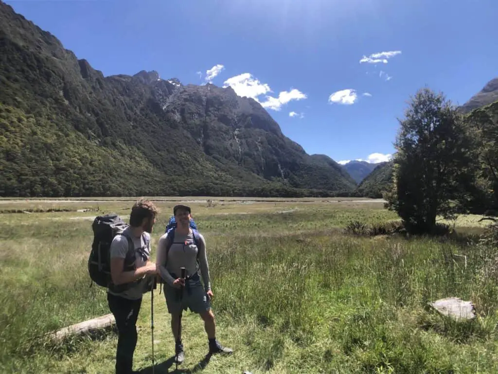
After a leisurely breakfast in Queenstown we headed off in our rental car for the 1 hour 10 minute drive to the northern end of the Routeburn Track known as the Routeburn Shelter and car park arriving at around 9:30am. We organised our packs and hit the trail.
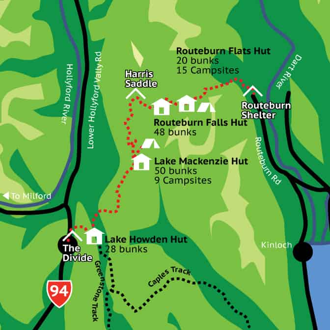
Routeburn Shelter Car park to Routeburn Flats Camp Ground (Approx 1.5-2hr):
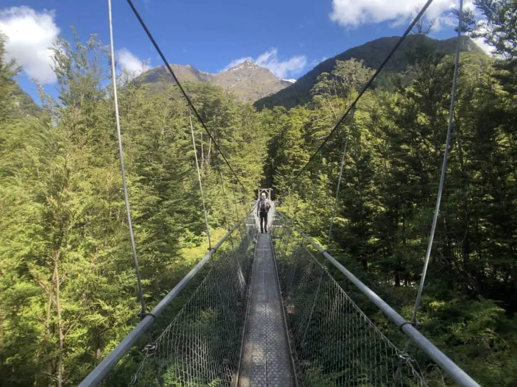
The hike starts off very mellow in a beautiful and shaded beech forest along a a very well formed track winding its way along the Routeburn Gorge and river, crossing a number of swing bridges. There are plenty of flat areas to get you up to speed and overall this segment is extremely easy. It’s more of a stroll than anything else.
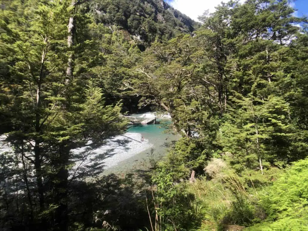
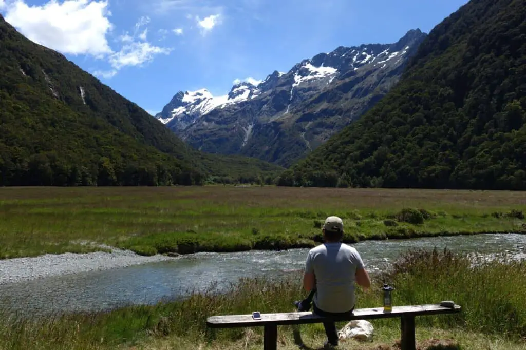
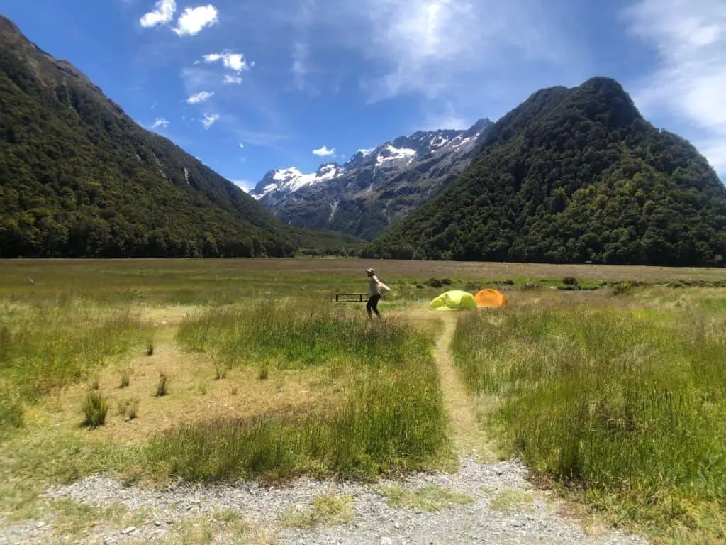
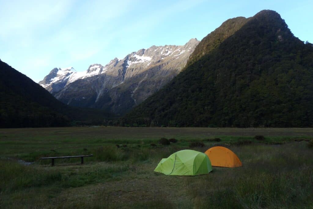
Arriving at the wide open grassed areas of Routeburn Flats and campground, we were greeted with stunning views up to mountains on all sides and what where would be spending the night.
We set up our tents, transferred some things into smaller day packs and got back on the trail.
Camp site to Routeburn Falls Hut (1 hr)
The trail from the flats immediately raises in elevation initially up a number of switchbacks and its a bit more effort from here. It was a relief to have shed the pack, as we kept climbing. Some more swing bridges, and with more elevation the views across the valley continued to change as we headed up.
Arriving at the Falls Hut, there was amazing views down through the valley from the impressive, large huts. Again, I was impressed by the quality of New Zealand’s hiking huts – these were extremely high quality. A quick look in the bunk rooms and facilities, the first thing that stuck out to me was how many people would be staying here (it was booked out and is booked out for months if not several months in advance). Our quiet open camping spot in the flats didn’t seem like such a bad option really.
Routeburn Falls Hut to Harris Saddle (1.5 hr)
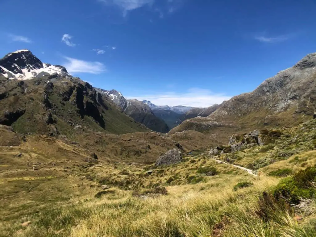
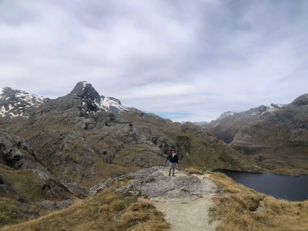
From the Falls Hut the trail is slightly more technical, however still very manageable. After a few hundred metres we entered the lower part of the open valley leading up towards Harris Saddle and this was particularly beautiful, with little stream meandering their way down the mountain. We passed a mother with her young son who had hiked up and over the saddle and were on their way down to the Flats Hut. The boy was desperate to get there!
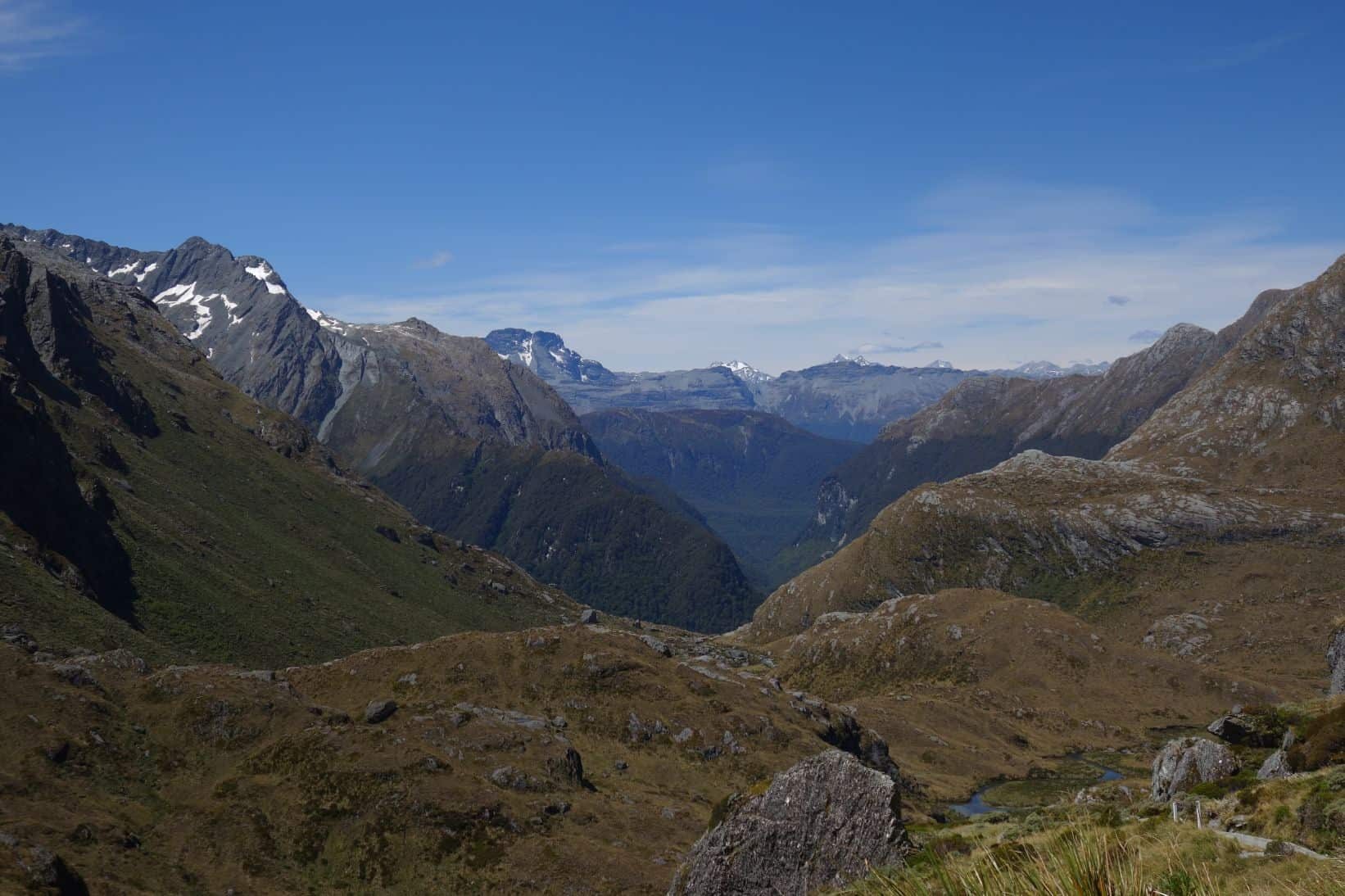
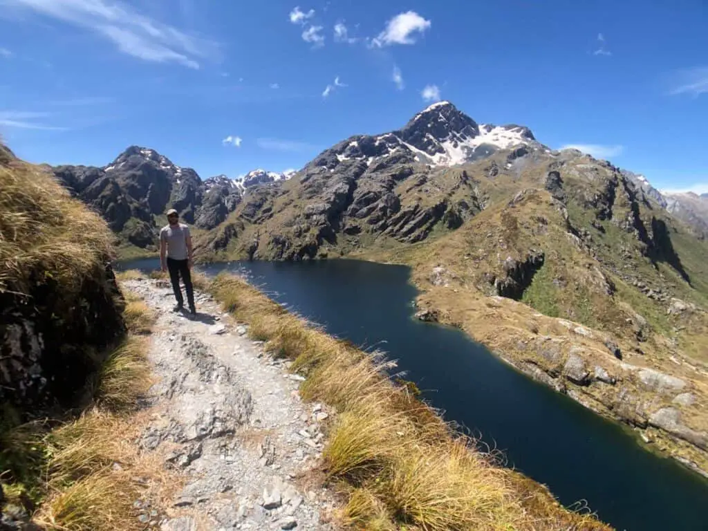
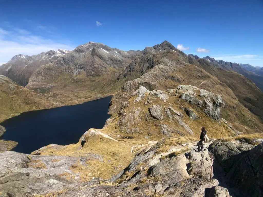
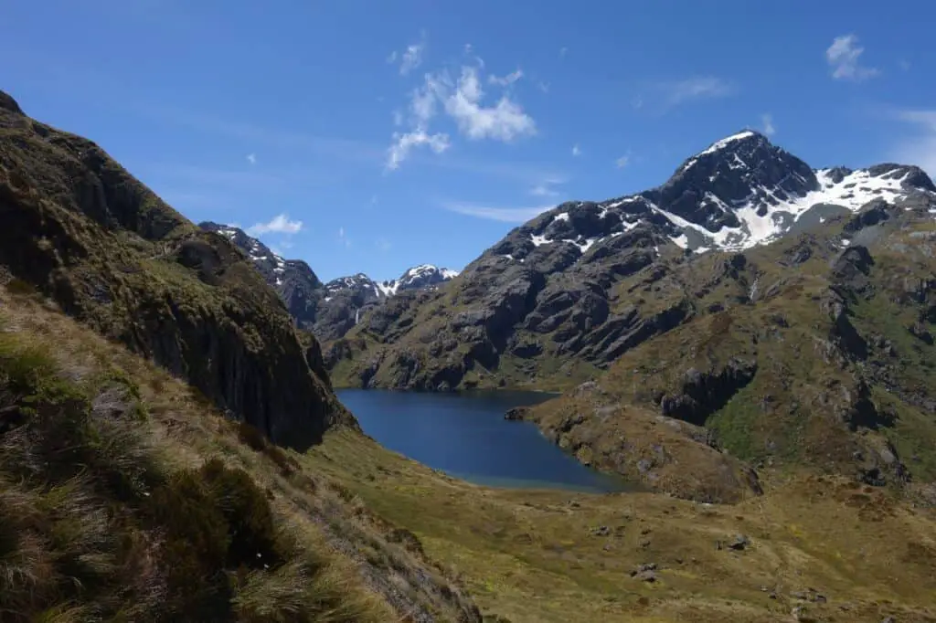
Towards the upper area of the valley we started to glimpse Lake Harris which was impressive and soon enough we reached Harris Saddle which is the highest point of route itself and houses an emergency shelter, to take refuge when the weather is particularly nasty, which lucky for us, we didn’t any signs of but of which we know comes with great regularity in New Zealand.
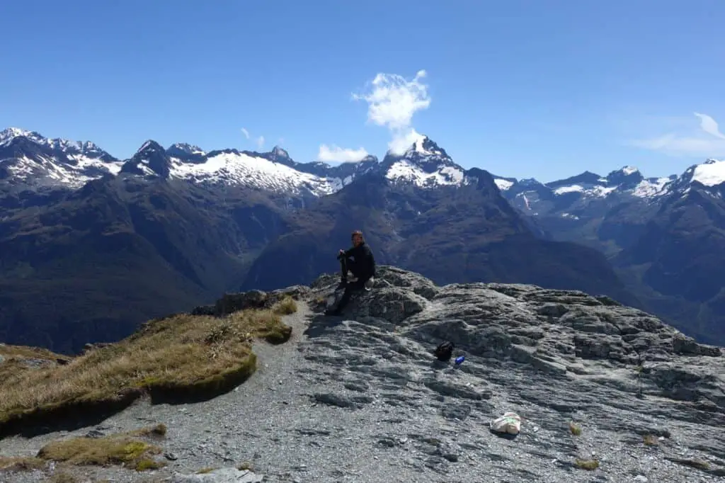
Conical Hill (30-40 mins up)
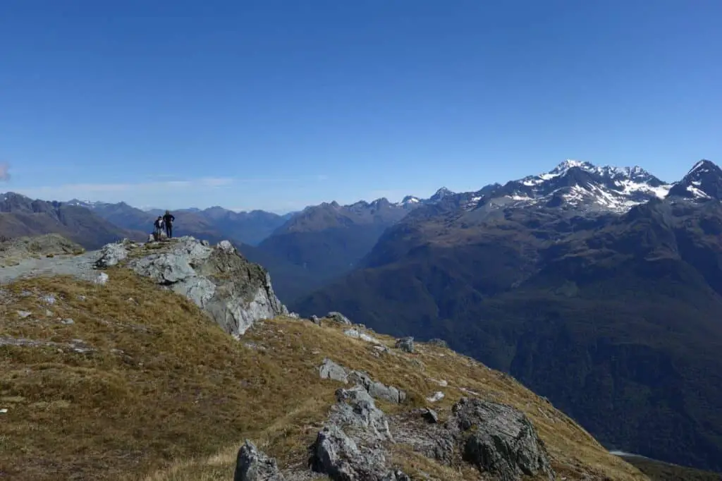
An optional trip (but a vital one) from here up to 1,515 m is Conical Hill. It’s a steep and unformed track up around and over rocks but not particularly challenging. The views from the top are out of this world in all directions. This is what the Routeburn is famous for.
Back to the Flats campground (2hr)
After a well earned break, food and lots of photos at the top of Conical Hill we started our descent. The trip down was obviously a lot easier physically but not so easy on the legs after the day of walking.
We arrived back to the Flats with beautiful sunshine still filling the valley and chatted with the local hut warden who warned us about mice. Apparently they were pretty rampant and especially at night.
We had our dinner and as the sun began to set the sand flies began to emerge so we retreated to our tents. I was pretty beat and fell asleep early. I did wake during the night to see a small rodent climbing the outside of my inner fly inches from my face. That was nice! Haha a bit of schock and I think I hit the fly and sent him on his way.
Hike out to Routeburn Shelter Car Park (1.5 hours approx)
It was an easy hike out after breakfast in the morning and back to the car. On our way back to Queenstown (which is a stunning drive by the way), stopping for coffee in Glenorchy.
Weather
We were incredibly lucky with the weather with perfect blue skies and sunshine. New Zealand is famous for its bad weather and with that in mind, it is important to have right gear and weather protection when it is required. Temperatures along the trail can change rapidly and I found myself needing to change layers a few times ranging from being extremely hot to chilly. Night time temperatures in the valley can be colder, even in summer, so a jacket and warm sleeping bag are definitely necessary to bring along.
Water
There is plenty of water available along the trail so it is unnecessary to carry large amounts of water.
Can you do the Routeburn track in a day?
While we opted to do this as an overnight return to our starting point/ car park, it is easily doable to return to the car park within a single day, and particularly without a heavy pack of camping gear.
Alternatively there are many people who do take on the whole 33km length of the Routeburn Track as a single day trip. It’s a long day, granted, but it can be done assuming you organise transport from the end point.
Reports of those that have undertaken it as a one day trip have completed in around 9 hours including stops and breaks. This is of course in clear weather conditions where is easy enough to have a quick and clear run. In poor weather this time could quickly blow out.
Is the Routeburn Track still closed?
In 2020 the Routeburn Track was closed due to extremely heavy rains which lead to landslides and damage in several areas. It was closed for the remainder of the year but as of 2021 is now open.
Planning your hike on the Routeburn Track New Zealand
Permits
If you’re planning to stay in any of the huts when hiking the Routeburn Track you must book in at least a few months in advance. Camping sites on the other hand, can be available to book without notice, which was the case for us booking them in the day before.
Both huts and camping sites can be booked via the DOC website: https://bookings.doc.govt.nz/Saturn/Facilities/SearchViewGW.aspx
How to get there and back
A negative point about the Routeburn Track is that it is point to point, not a loop track and if you were do it from one end to the other you will need to find your way back to your vehicle or find other transport. The northern end of the track is near the town of Glenorchy and the southern end is near Milford Sound. it takes approximately 4 hours by car from one point to the other as the roads have to travel a long way around the chain of mountains.
Aside from driving your own car to the Routeburn Shelter car park there are companies such as Glenorchy Journeys who offer shuttle services to and from Queenstown – see more information HERE.
If you are hiking end to end and parking a vehicle at one point, companies such as EasyHike or Trackhopper will relocate your car and it will be waiting for you at the end point of the Routeburn track.


[…] you’re planning on taking a longer overnight hike, knowing your pace means that you can plan how quickly you’ll get to the […]