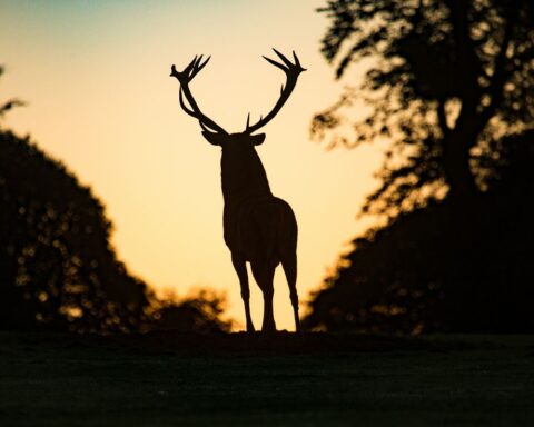
The Dolomites are truly a hiker’s dream. With spectacular mountain ranges as far as the eye can see, a seemingly endless list of hiking routes to choose from, and unique accommodation dotted all over the mountains, the area rates as one of the world’s best hiking destinations.
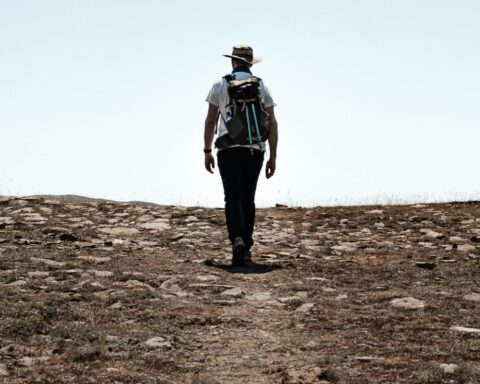
But did I mention the biggest positives? Hiking hut to hut means that you can do away with the heavy hiking pack. A day/smaller pack is all you really need, which over multiple days of hiking makes it far easier and enjoyable. Further, access to the many “Refugios” (Huts) of the Dolomites rewards the weary hiker with the kind of luxuries not typically found when multi day hiking – nice meals, comfortable beds and beer if you are that way inclined.
I had often dreamt of visiting the Dolomites after stumbling across some stunning photos of the area’s unique mountains and lakes several years ago. On a holiday to Germany to visit my wife’s family and friends, I saw an opportunity to duck off for a few days of hiking in the Dolomites in July, at the start of the hiking season.
As I started to research the area, the first thing that became apparent to me was the vast number of Dolomites Hiking routes and Refugios. I realised quite quickly that I would be better off to engage with a Dolomites expert to customise the best hiking itinerary that would suit the 4 full days that I factored I could commit to hiking – excluding 1 day either side to travel to and from the Dolomites.
Our Dolomites Italy Hiking Hut to Hut guide will highlight how I went about arranging my trip – to make it a whole lot easier, and my thoughts about what I saw and experienced over 4 magic days in the mountains.
Happy reading.
The Details
Distance: 48km Total
Duration: 4 Hiking days
Start / Finish: Pizza Di Fassa (Basecamp Hotel)
Direction of Travel: One way point to point route over 4 days
Elevation Gain: Daily elevation gain and descent was between 800 m – 1200 m approximately (exception being 1,500 m descent on day 4)
Max Elevation: Just shy of 3,200 m
Difficulty: Difficult in some sections – I would suggest this would be suited to moderately experienced hikers
Season: Summer only – Early June to late September
My plan for the Dolomites Italy Hiking Hut to Hut
With a few weeks in Germany visiting my wife’s family with our young son, I (somehow) was able to convince her to let me disappear for a few days to hike in the Dolomites. 6 days to be precise, which gave me a day to travel to Bolzano, Italy and then up into the Alps where I spent a night in the village of Pozza di Fassa. The plan was then for 4 days / 3 nights of hiking to eventually return to Pozza di Fassa before leaving the next day from Verano by plane back to Germany.
I used an Italian trek booking agency called Mont Trekking to arrange the hiking itinerary as well as booking of a basecamp hotel in Pozza di Fassa for 1st and last nights, transport to the starting point for the hiking as well as the booking of the 3 Refugios (huts) that I would stay in along my journey. They have options for self guided hikes (which is what I chose) or guided group hikes.
I highly recommend them, they were really quick to respond and always helpful, provided great detailed information, hard copy maps as well as digital GPS mapping (via phone). On the day that I finished the hike, they emailed me to notify me of train strikes that could have impacted my travel plans the following day and assisted me to make some alternative arrangements. I was super impressed and wouldn’t hesitate to use them again the next time I’m lucky enough to visit the Dolomites.
Trip notes – Dolomites Hiking Guide
Travel to Pozza di Fassa
My journey started from the south of Germany outside of Munich where we had been staying for a few days with some friends. Jumping on a train from here I had a fairly easy ride of a few hours to the city of Bolzano, the capital city of the province of South Tyrol in northern Italy which is a gateway to the Dolomites.
Arriving in the centre of town at the Main Train station, I was to take a bus from the adjoining bus station up into the Alps. Checking the bus schedule it turned out I had an hour or two’s wait so I took the opportunity to have a quick walk around the city, and sit down for a beer. It was hot as hell, but a nice city. From Bolzano you look up to the Dolomites and the intimidating classic “Dolomites” of jagged rocky peaks are already so dominant from there.
The bus ride to Pozza di Fassa winded its way up the mountains and after an hour or so I found myself in the small town. I found my Hotel, checked in and got myself prepared for the next day. The hotel itself was pleasant, filled with Italians and run by friendly staff. A big plus was that I was able to leave a bag and unnecessary things that I wouldn’t need on the hike itself, taking only a lighter day pack along with me.
Day 1 – Passo San Pellegrino – Rifugio Contrin
Ascent 790 m. Descent 680 m. Distance 10 km. Walking time 5-6 h.
It may not look it from the above specs but this day was actually quite challenging and more strenuous than you may expect 10km to be.
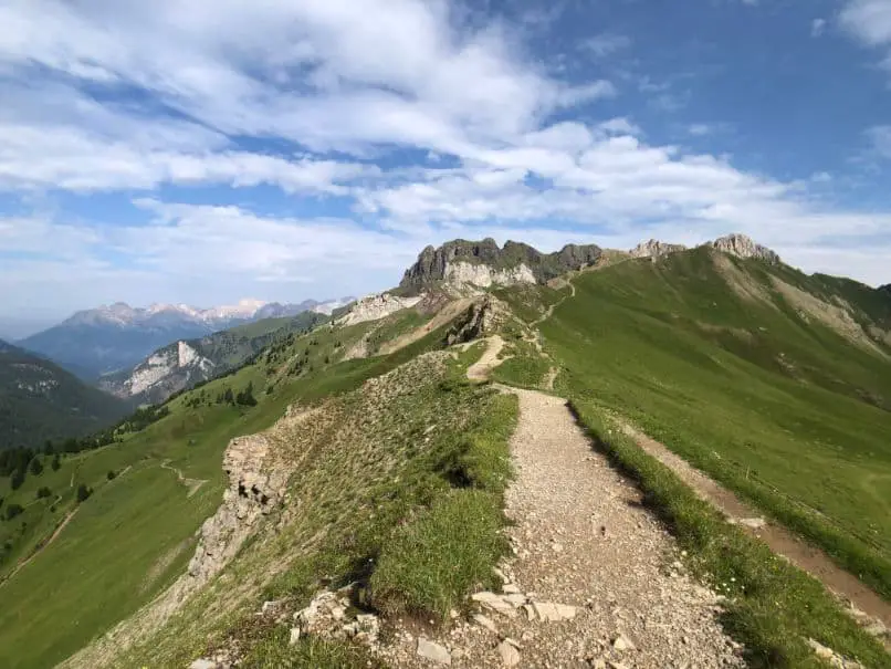
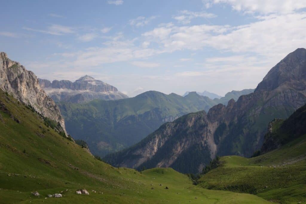
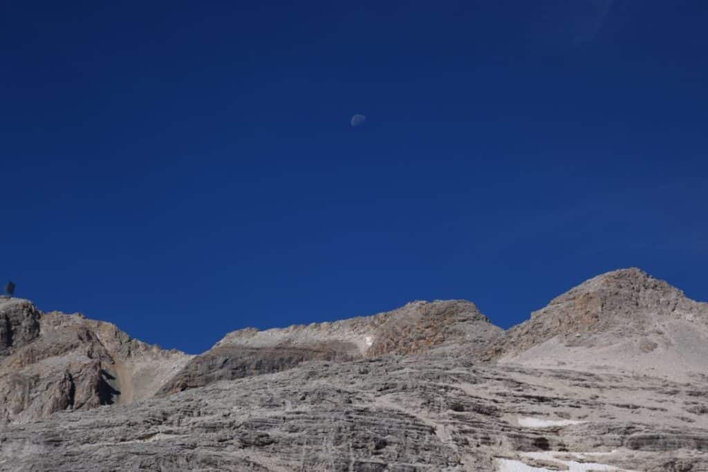
Starting in a lush green valley the views up to the mountains above were an impressive kick off point hiking in the Dolomites. The clouds dramatically cut across the mountains, with otherwise blue skies, which reminded me that the weather could shift at any moment. The weather outlook itself was good, but the guides suggested that weather particularly in the afternoons often changed, with the advice being get the bulk of your daily hiking done in the morning.
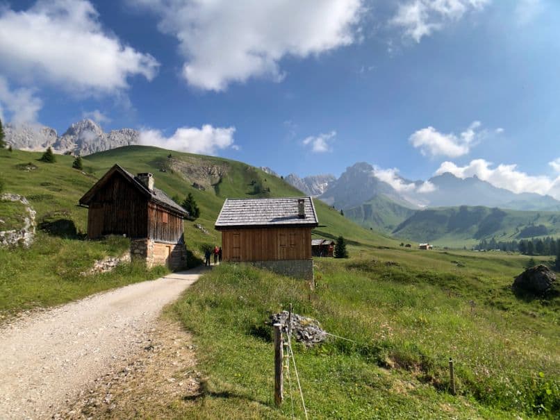
Very early on I passed by a lovely Refugio which sat at the base of these mountains. It looked like a nice place to stop but I kept on walking, wanting to make a start on the mountain pass the lay ahead of me.
The elevation quickly increased as I got higher the “lunar landscapes” which I’d read about began to materialise as the green valley was left behind. Winding my way up this section was steep and rocky. I passed several groups of people in the lower sections of the climb but as I neared the pass I was surprised to not see a soul from that point until an hour or two later.
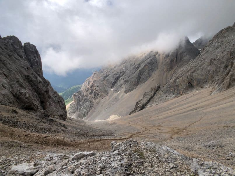
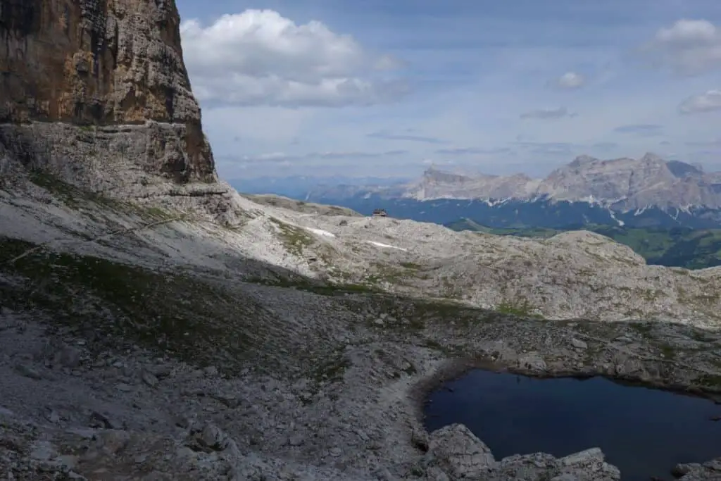
In the weeks leading up to my hike, this area had been battered with harsh cold weather and in fact the section of the pass had been closed. It had just reopened in the week prior and evidently few people. As I came over the rise at the pass (Passo Cirelle) I was greeted with an impressive site looking down the valley, with large sections of snow and ice, effectively a frozen body of water which would later in the season flow down the valley.
The GPS noted a non existent trail straight over the ice here and with noone to be seen or heard of in the whole valley, I was somewhat nervous. Not only that, there was not one foot print visible over the ice. With great deliberation I eventually pushed on testing the snow with my poles each step I took. I sighed with relief when I finally hit the other side and began the windy descent down into the valley.
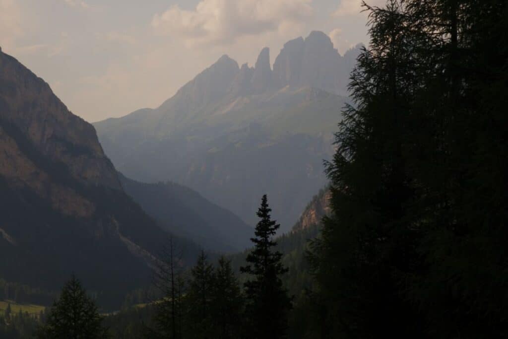
Like the side I had come from that morning, the further I descended another lush green valley appeared with amazing views to a mountain in the distance that I would continue to see from many different angles over the coming days as I twisted my way through the Fassa valleys.
At around 4pm I had made my way down to my first night’s accommodation – Refugio Contrin. With the afternoon sun shining through the valley I had a beer on the deck. What a way to finish a day of hiking.
Despite literally being the only non Italian person in the the Refugio, this was a decent hut with a particularly impressive dinner. The food was great. Accommodation was fine also, nothing flash – with dorm rooms.
Day 2 – Rifugio Contrin – Lago Fedaia
Ascent 1190 m. Descent 1180 m. Distance 18 km. Walking time 7 h.
The second day was less technically difficult but it made up for it in distance.
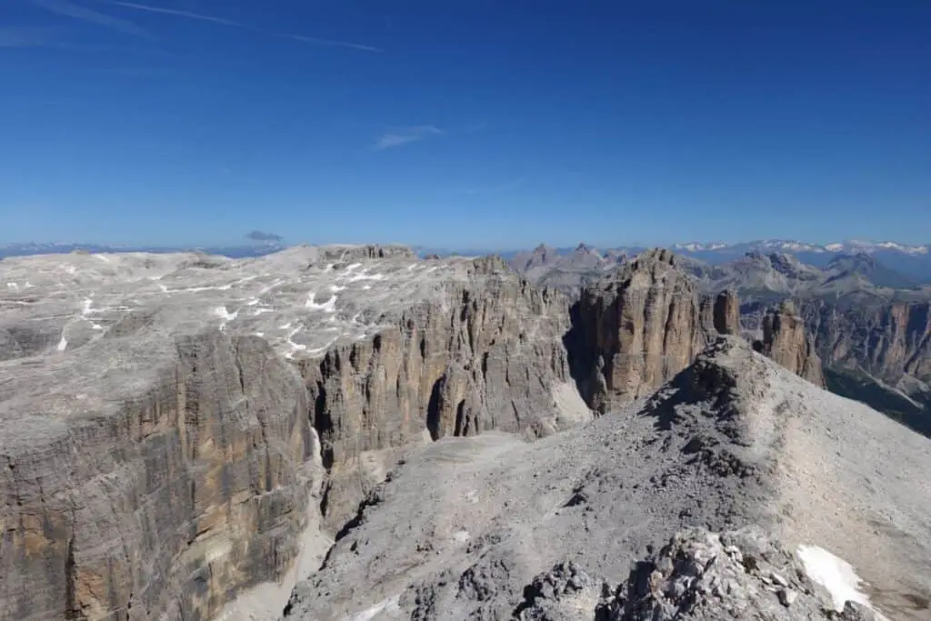
After breakfast served at the Refugio Restaurant, it was back onto the trail which took me up again and further around the valley revealing some of the most impressive views of the entire trip. The amazing thing was the sheer variety of views and landscapes as I made my way up, around and through each valley. Again, for the first few hours of this day I passed very few people. This surprised me, and I put it down to the huge number of routes through these mountains.
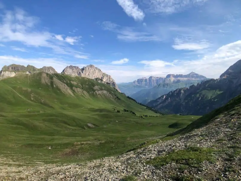
Passing through a spectacular group of peaks, and some steeper sections aided by steel hand holds, I eventually began another descent down into what is a main ski area during the winters – the Ciampac Ski Resort.
This valley was more populous due to the Gondola lifts bringing people up from the valley floor. Meandering my way down I arrived at a group of restaurants at the Gondola Station that would take me down to the town of Alba. Taking the opportunity I had a pizza for lunch. Talk about comfort hiking!
From Alba a trail split off to the side of town and I followed this mostly through forest but sometimes along road for several kilometeres to my destination for the day – Lago Fedaia. This section particularly for the first 4 or so kilometres from Alba was the most underwhelming section of the 4 days of hiking and I was quite tired by the time I reached the Refugio Marmolada (there was an option to take a bus from Alba all the way to Refugio Marmolada which would cut this out, but I felt like that was cheating and as it turned out I would be taking a bus the following morning).
Refugio Marmolada was quite rundown but had a certain rustic charm about it. It is positioned on the side of Lago Fedaia and looks up to the Marmolada Glacier, which is the only glacier of the Dolomites section of the Alps. When I arrived at the Refugio I enquired about upgrading from my dorm booking to a private room and lucky enough I was able to, ensuring a better night’s sleep than the previous night in the dorm.
Day 3 – Lago Fedaia – Rifugio Kostner
Ascent 910 m. Descent 720 m. Distance 9 km. Walking time 9 h.
Well rested, the 3rd day was apparently a variation of the normal route due to damage on one of the trails. As such the first step involved catching a local bus from directly outside the Refugio Marmolada back to Alba where I had descended on the cable car the previous day, to this time take the Gondola up on the opposite side of the valley to Col Dei Rossi.
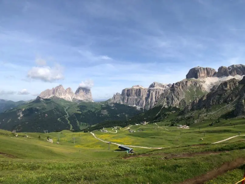
The Gondola station was packed and there were hundreds of tourists and day hikers up there. It was a big change to the previous days, but evidently this section at Col Dei Rossi, also a major ski area in winter with a number of restaurants and easily accessible amazing views was very popular. I joined the masses in first climbing up and then down gradually to Pordoi Pass (Passo Pordoi). At Pordoi, a small touristic village with stunning views up to Sella Group of mountains to one side and the Marmolada Group on the other, I had a coffee and then carried on my way.
I had been beginning to wonder if I’d be hiking amongst many people for the remainder of the day but was pleasantly surprised to see very few people as soon as I left the town and towards the next climb up into the mountains.
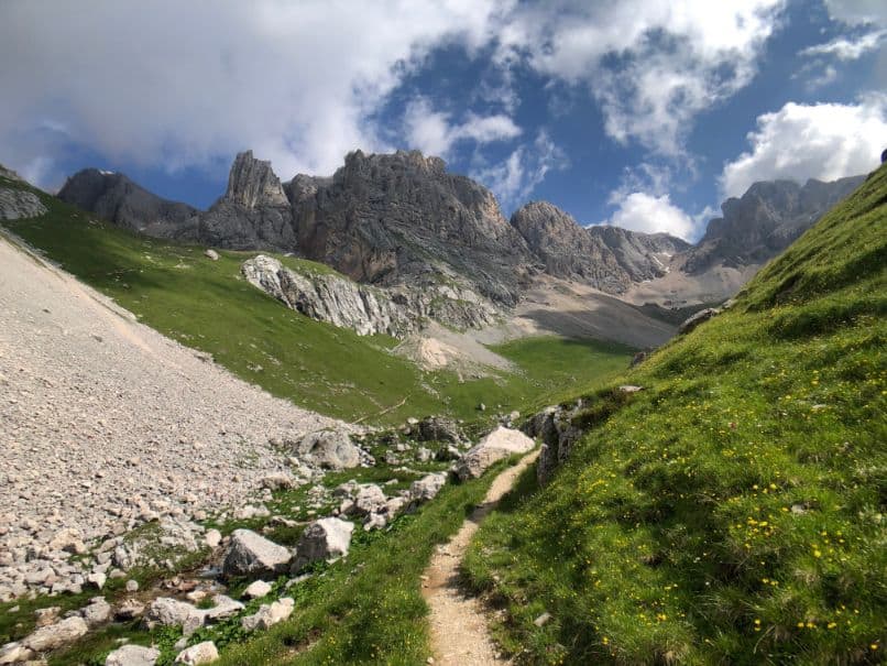
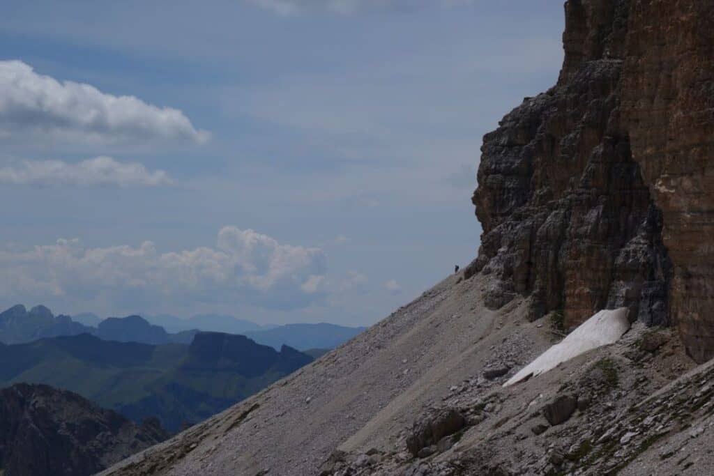
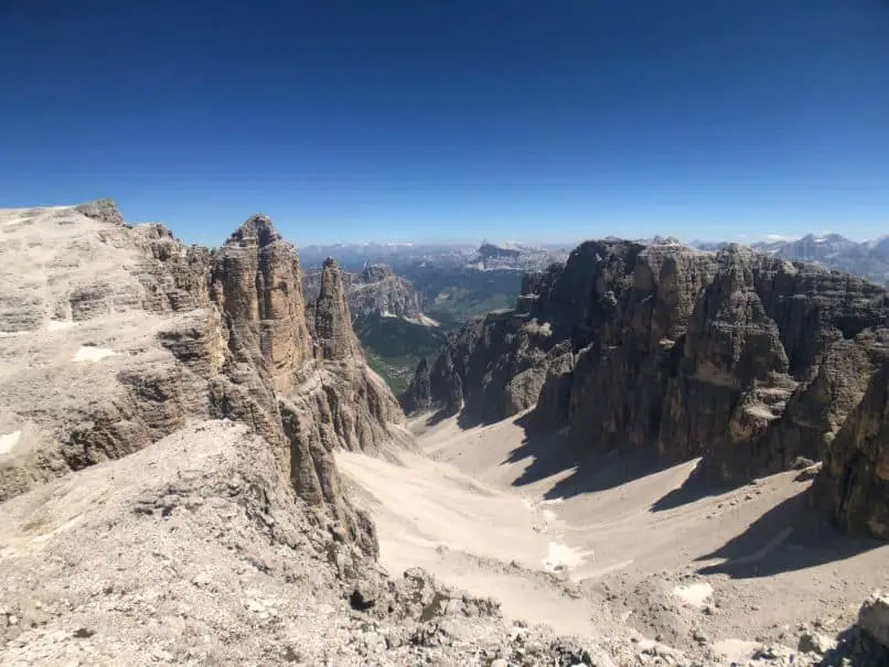
The real action for the day started with a fairly steep trail which winded its way up, eventually reaching the base of a sheer cliff face towering up as far as I could see. For the whole way up I wondered if the route would continue somehow up and over but it soon became apparent that from here the trail would continue along the base of these rock faces all the way to my final destination.
There were sections of ice to cross and the trail was quite narrow for the majority of the route but overall not as technical as it first appeared. I passed several groups coming in the opposite direction, but it was fairly quiet. An amazing contrast to see of people at Pordoi.
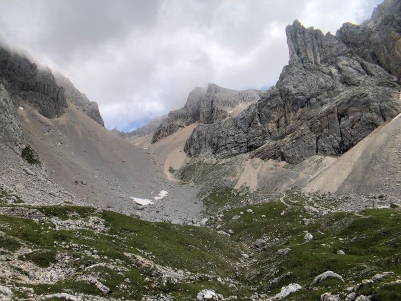
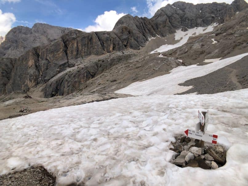
Along the narrow trail hugging the base of the rock face there were very few routes up. The first I had seen was a rock climbing route – no thanks. The second that I passed was a very steep section of snow that eventually in the distance looked to continue up a crack in the rock face. Checking my maps and route plan for the next day I could see that this was apparently the route (trail 638) I would be taking up the mountain the next day (this meant from my day’s destination to this point in the morning). I saw a group making their way down through the snow here and to be honest, I wondered how I would make it up there in the morning!
I continued on with thoughts of the next’s days climb on my mind, and as I rounded a bend in the trail, caught view of an amazing outlook towards the Refugio Kostner, which was to be my final night’s accommodation along the hiking route. Refugio Kostner sits basically at the edge of the mountain in one of the most stunning locations I’ve ever seen.
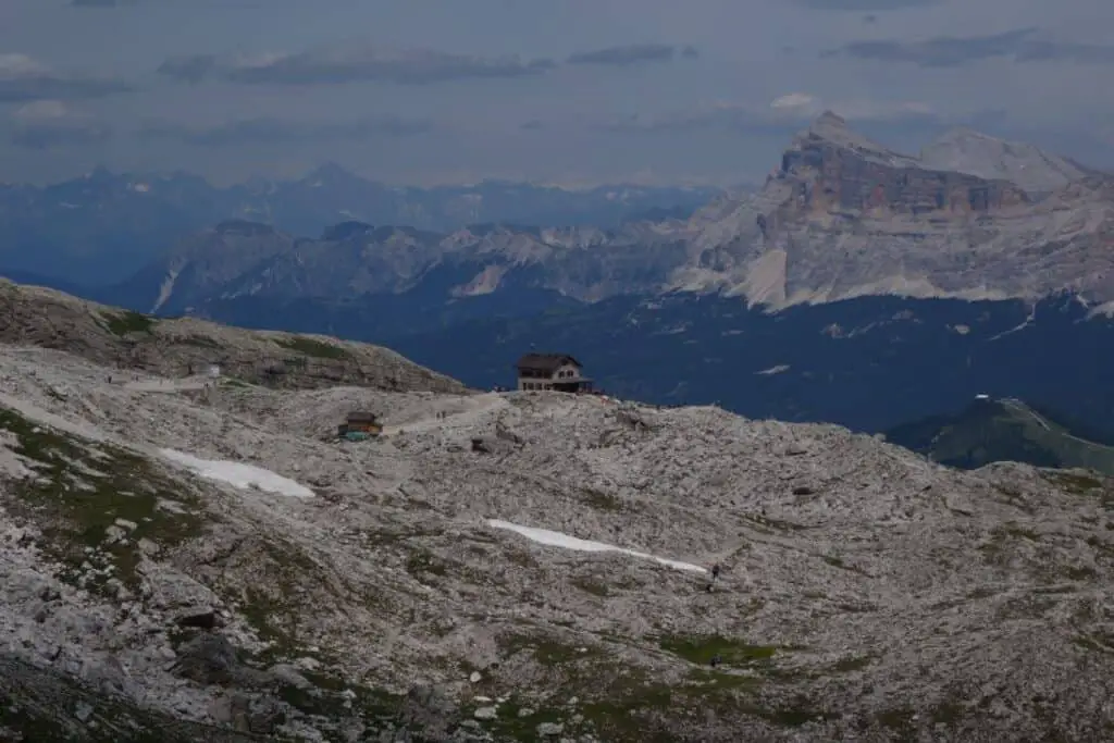
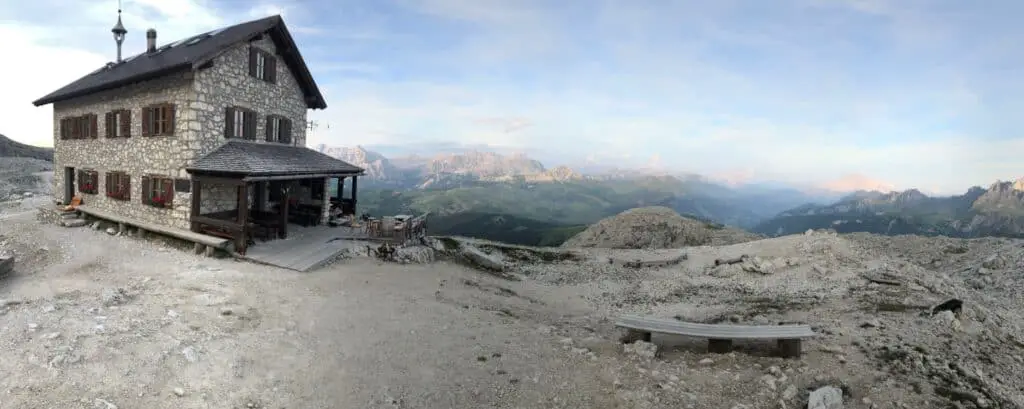
As I got closer I could see (and hear) quite a number of people hanging around the small Refugio Kostner. Clearly a popular spot for hikers for an afternoon beer. I checked in, was led to my room upstairs which was effectively brand new – the whole place had recently been renovated, and made my way downstairs to enjoy a beer myself and study the maps for what was looking like a fairly challenging route the next morning!
Refugio Kostner was an amazing place to spend the night – the food and service was fantastic, the rooms comfortable and modern and the views were really something else. Hands down must do in my books!
Day 4 – Rifugio Kostner – Rifugio Monti Pallidi – Val di Fassa
Ascent 860 m. Descent 1540 m. Distance 11 km. Walking time 7 h.
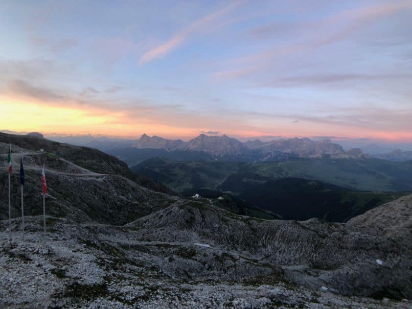
Waking up to a crystal clear blue sky day, I enjoyed a great breakfast and sought some help from the Refugio’s manager with my route for the day. The hiking plan I had to hand recommended to take route 638 which I had seen the previous day and to avoid the trail 672 due to it being Via Feratta. The lady suggested that 672 was as doable, if not easier than 638 with the trail beginning more directly from Rifugio Kostner. I took her advice and decided to take that route, although in my head I still had doubts and didn’t really know what to expect.
I set off and made my way to the 672 trail junction and looking up at my destination, could not for the life of me work out how this route would end up at the top. As I approached the rocky face of the mountain the trail began to zig zag it’s way up with some quite steep sections which had steel wire hand holds and supports. I’m not amazing with heights and being that there was not a person to see behind or ahead it was a little spooky in a few sections but eventually I made it up to what resembled a more regular walking track.
More and more amazing views were revealed and as per my previous days I was constantly blown away by the Dolomites and what would appear at the crest of each peak.
Eventually looking back the way I came I saw another group ascending the same route, which gave me some more comfort and as I got closer to Piz Boe I could see more and more people. Piz Boe is the highest point of this range and it is extremely popular as there is another Goldola access point on the other side of where I ascended. I reached a junction and in turn a steady flow of hikers moving up and down to Piz Boe.
Descending down into the valley below I stopped at Refugio Boe for a coke and a snack, sweating as I arrived. It was extremely hot by this stage of the morning on top of the mountains, noticeably more so than the days previous (I would later find out that a heat wave was descending across Europe). This Refugio was packed with people and I quickly moved on.
The remainder of my final day was a long and steady descent winding through the valley. In the heat, I was beginning to feel quite fatigued after the 4 days of hiking but found the route down to be pleasant and unlike the areas I had seen to that point. Starting with the barren and rocky landscape at the top, eventually changing to a lovely lush valley with icy cold water streams running through the middle of it – which was amazingly refreshing to splash over the face.
In the lower sections I passed pine forests and finally the end point of my hike. From here, I caught a bus to the town of Canazei and then another back to Pozza, returning to my original Hotel.
It was at this point I found out that there were train strikes occurring throughout Italy the following day, which meant getting a train to Verano for my flight back to Germany would apparently be a no go. After some back and forth with Mont Trekking and the Hotel staff, I made plans to catch a local bus to Trento and booked with Flixbus from there to Verano. It all worked out for the best, I made it to Verano which in the aforementioned heat wave, was stinking hot and caught my flight back to Cologne.
What is so good about Dolomites Hut to Hut hiking?
For me, and I would imagine many hikers from other areas around the world, hiking in the Dolomites offers a very unique experience.
For me, as an Australian -multi day hiking trips usually involve tents, mats, sleeping backs, food, water and heavy packs to sustain a few days without access to any supplies.
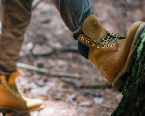
In the Dolomites, being able to travel with a small day pack taking only a day’s supply of food and water, some essentials, clothes and hiking poles made the actual hiking easier and more enjoyable.
Being able to stop in at Refugio’s/ Restaurants up in the mountains along a days route for lunch and a beer is quite a rewarding experience, and at the very least a great dinner, shower and a bed at the end of the day certainly is a nice change.
Don’t get me wrong, getting away from it all and roughing it without these creature comforts is an amazing experience in itself and all part of the challenge for me, but this different style of hiking was an interesting and enjoyable experience which I will certainly look to do again.