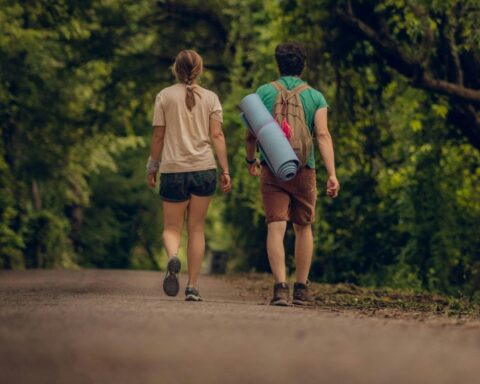
The second of two smaller hikes that we did in our week in Tasmania was the 2-3 day Freycinet circuit. The Freycinet National Park hike is not overly difficult, but it is stunning and offers some variety over the 2 main days of hiking – the first day hugging the spectacular coastline and the 2nd heading up and over the pass to the other side of the peninsula.
Prepare yourself for crystal blue waters, plenty of opportunities to swim and for the reason why most people visit the Freycinet National Park: Wineglass Bay.
The Details
Distance: 31km approx
Duration: We did this in 3 days, 2 nights – but could quite easily be done in 2 days if you were in a rush.
Start / Finish: Wineglass Bay car park in Freycinet National Park.
Direction of Travel: Anti-clockwise
Elevation Gain: 1,410m
Max Elevation: 590m
Difficulty: Easy to intermediate
Season: This Freycinet circuit can be done at any time of the year
Our plan for the Freycinet Circuit
Having just completed a couple of days hiking at the Walls of Jerusalem National Park, we made our way across to the East Coast stopping briefly in Launceston on the way through for some more supplies. Our plan was to arrive at the Freycinet National Park the following morning and spend two nights on the trail. The 3rd morning being a short 5km hike from Wineglass Bay back to the car park.
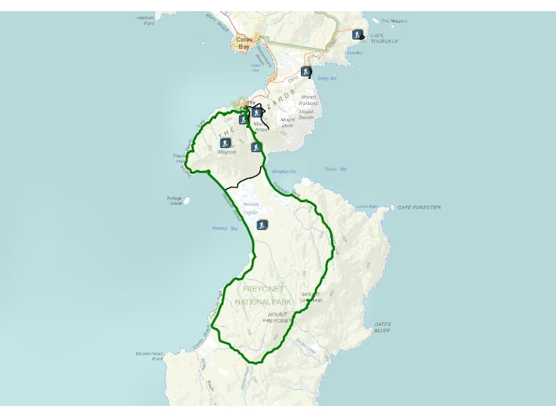
The following trail guide follows the Freycinet Peninsula in an anti-clockwise direction. This direction is recommended by Parks and Wildlife to help stop the spread of root rot (Phytophthora).
Trip report/notes – Freycinet national park hike
Day 1 – Coles Bay to Cooks Beach (12km)
We drove into the Freycinet National Park arriving at the main car park at around 8:30 am. The car park was already quite full and didn’t take long to completely fill up while we gathered our gear and finalised our packs.
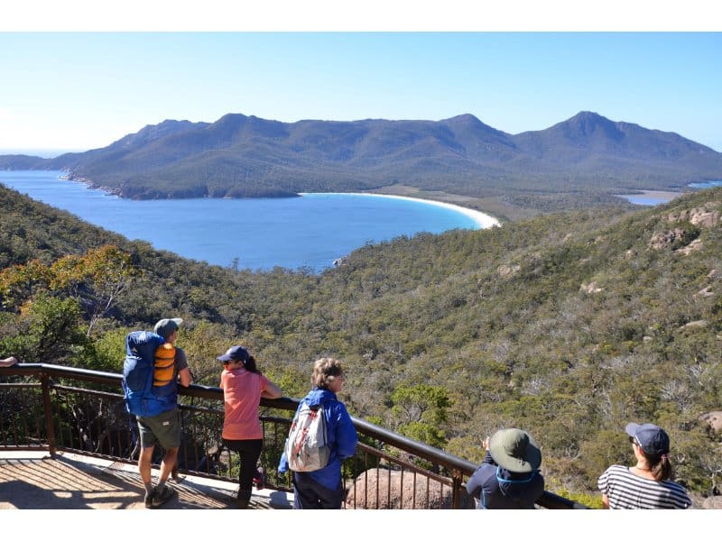
This car park is also the starting point for day trippers heading to the famous Wineglass Bay (or it’s lookout) and with all the people we started to wonder whether we were going to be hiking shoulder to shoulder with the crowds.
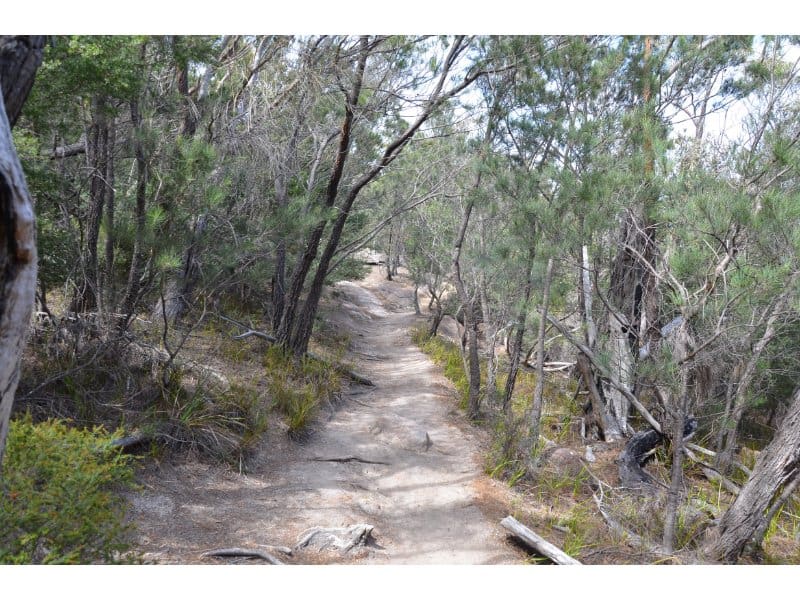
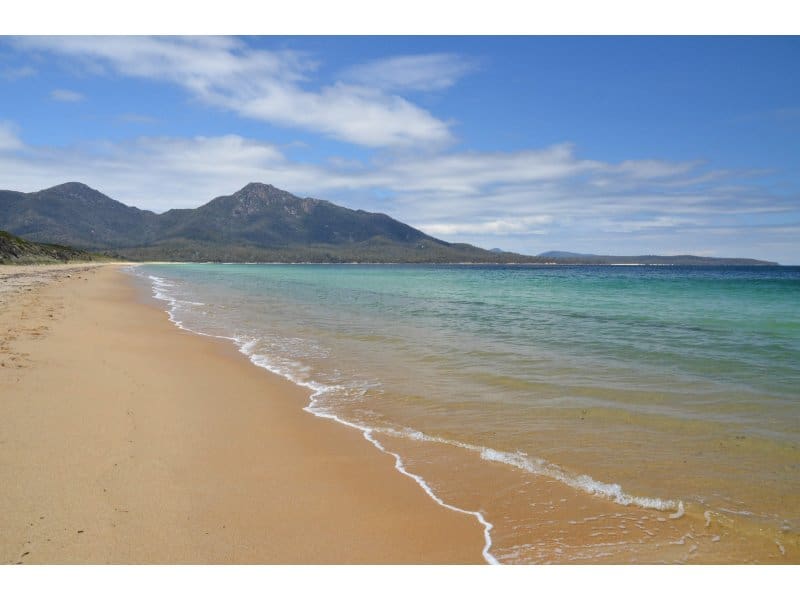
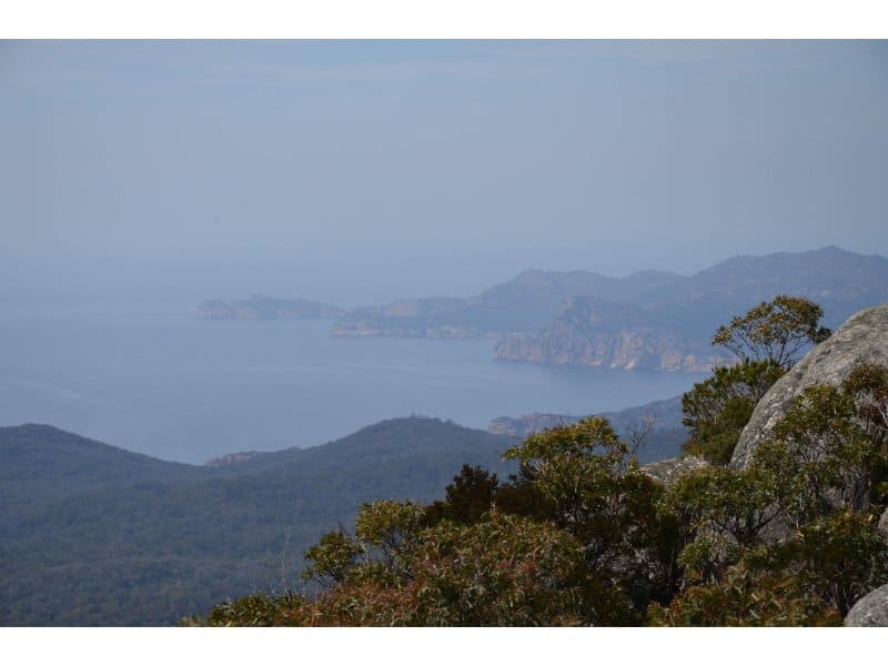
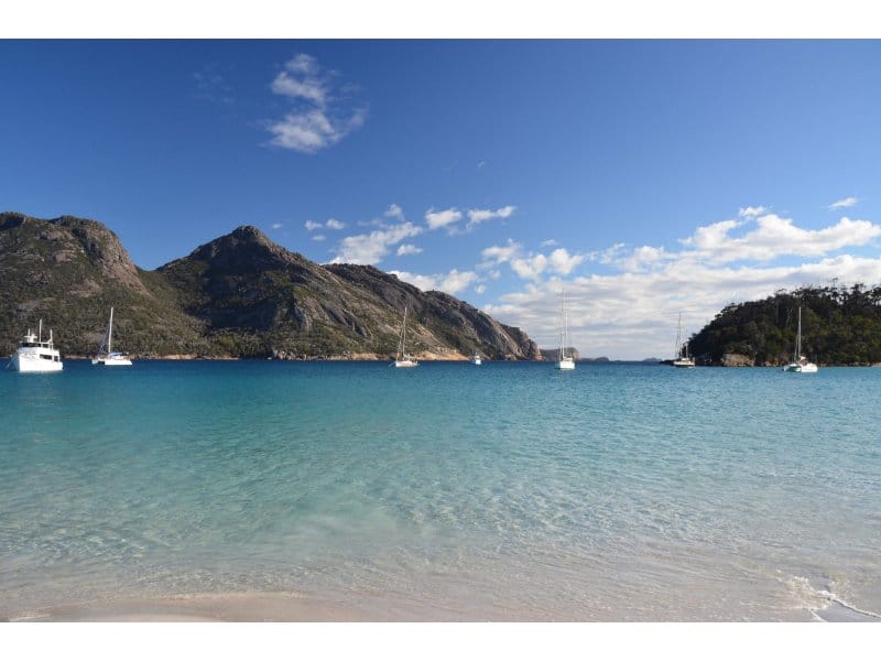
We got started on our way off for Hazards Bay, taking on the circuit counter-clockwise as the authorities recommend. Thankfully, after forking off the initial path towards Hazards Bay – the Wineglass Bay crowd dropped away. The track to Hazards Bay is a straightforward affair with some slight undulations and then a few kilometres on the beautiful beach itself.
It was hot, however admittedly not as hot as a few days prior when the park had actually been completely closed off due to heatwave conditions. We’d made the fortuitous decision to head to Walls of Jerusalem before Freycinet and how lucky we had been. With blue skies and picturesque water, it was a real haven and although there were a few people around it was very different picture compared to the start of the walk.
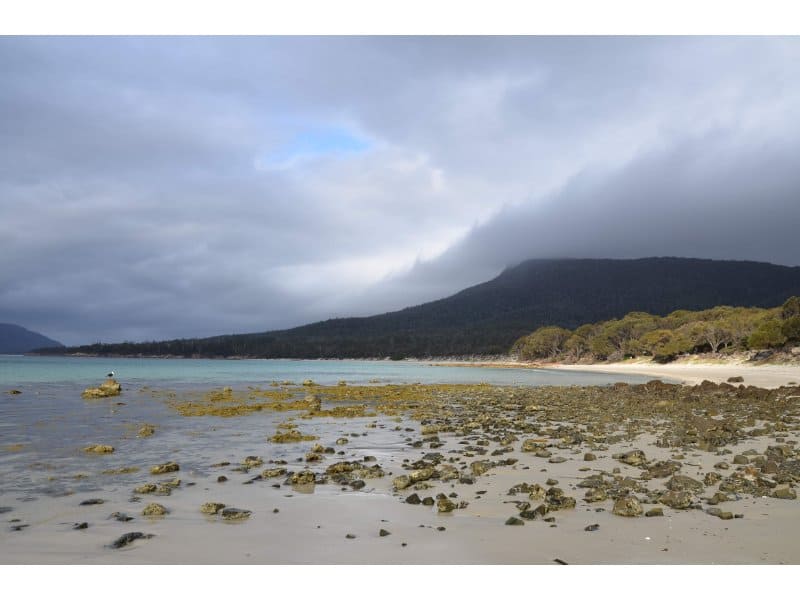
After a 2.5 km stretch along Hazard Beach, we took a well earned rest, enjoyed a swim to cool off and some lunch on the large rocks.
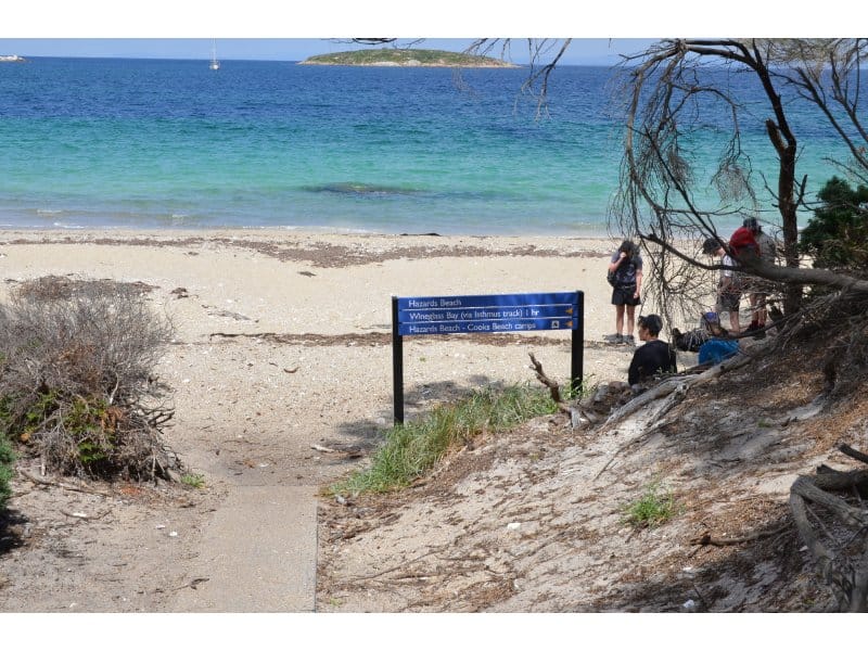
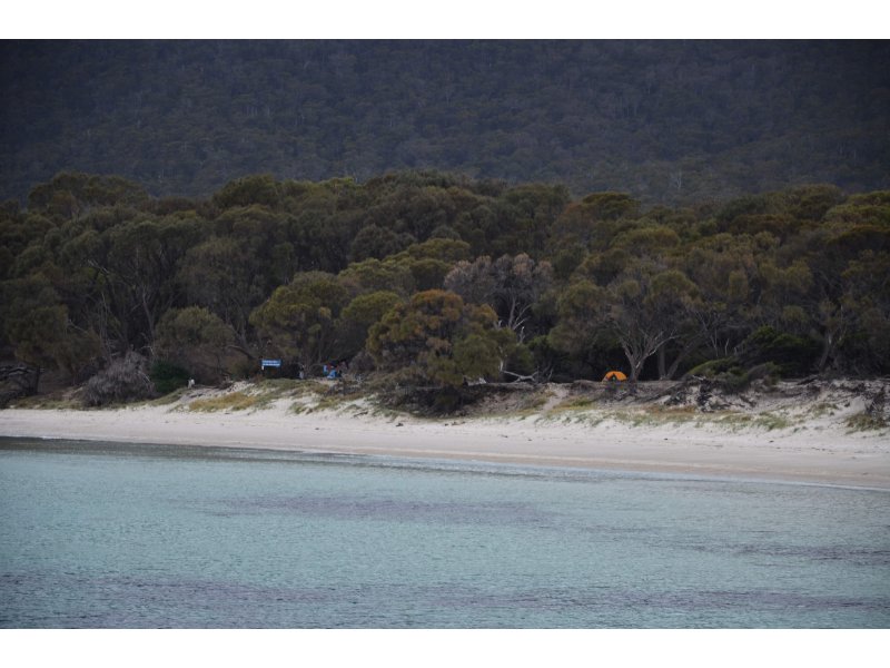
Passing through a campsite just beyond here (with toilet) we followed the off beach trail for the next 3.5km before reaching the northern end of Cooks Beach, which is even more spectacular than Hazards. With almost no one in sight, it is a real paradise.
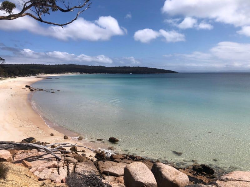
The Cooks Beach camp site is located at the other end of the beach 1km away, so it back onto the beach for the last stretch. Located just off the beach, this picturesque campsite is the most logical place to spend the first night of the Freycinet circuit. Just a 100-200 m inland is a water tank adjacent to a Cooks Beach Hut (day use only) which had plenty of water while we were there, but reportedly can run low in summer season.
This first day’s hike is fairly easy going and most should complete in around 5 hours. If you’re interested there is a further 1.5 hour return trail to Bryans Bay which also has a small campground though no toilet or water facilities.
We were content to set up our tents in a great spot right on the edge of the beach and take it easy, enjoying the last few hours of the afternoon.
Day 2 – Cooks Beach to Wineglass Bay (14km)
If Day 1 was easy, Day 2 certainly made up for it with a lot more uphill.
Starting off reasonably early we knew we were in for a bigger day. Back tracking a short way back the way we came on Cook’s beach there is the trail heading inland towards Mount Graham. Starting off with a gradual climb which becomes quite a bit steeper it is approximately 5km to reach the saddle between Mt Graham and Mt Freycinet.
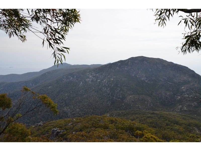
At this point, you have the option of temporarily ditching your pack and climbing to the top of Mount Freycinet which offers the highest views in the national park.
Free of the packs the summit is reached in less than 1 hour. This climb is the most technically difficult section of the hike but experienced walkers will have no issues.
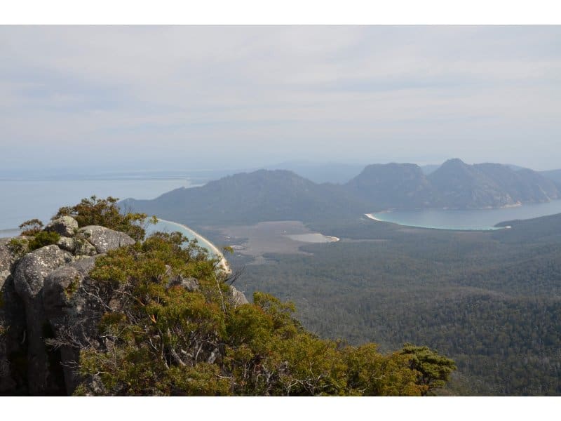
Once back at the saddle and with packs on the back, it’s another climb to the summit of Mt Graham. The track is steep but well-formed and offers tonnes of great views to take in while catching your breath. Past the summit, the trail continues across the ridge line before slowly descending to Wineglass Bay over the next 2 hours.
The descent to Wineglass Bay goes on and on, occasionally glimpsing Wineglass Bay, it felt like it was never getting any closer.
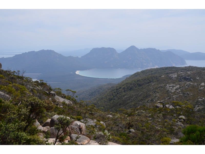
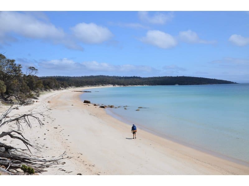
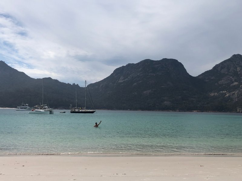
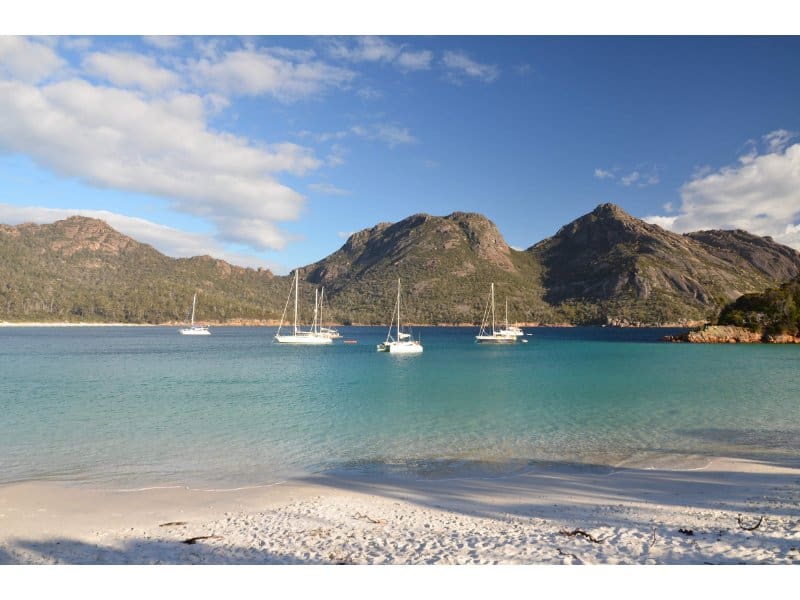
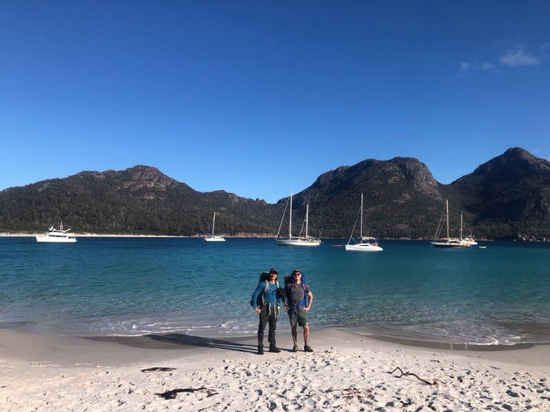
Eventually, tired and weary, we emerged from the trees at the Southern end of Wineglass Bay and immediately could see just why this place is so famous. With stunning quartzite white sands, crystal clear water, some sail boats and the back drop of the “Hazards” (mountains) – it is truly an unforgettable site.
All the strains of the previous few hours descending from Mount Graham were quickly forgotten, even though the legs ached.
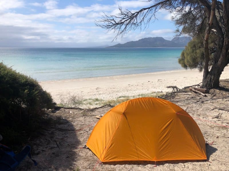
Some of the better camp spots right on the beach front were taken, so we settled for an area further back under some trees. There is a small creek which runs by the campsite but its quality cannot be assured – best to treat any water. There were quite a few mosquitos here, whereas at Cooks Beach they were not noticeable.
A small creek runs past the campsite but its quality cannot be assured.
Day 3 – Wineglass Bay to Coles Bay (5km)
The walk back to the Car Park is only 5km from the camp site at the end of Wineglass Bay, so it’s hard to really call this a day of hiking. You could realistically walk out from Wineglass Bay at the end of the 2nd day, but to be honest – why would you? 😉 One of the best parts of the Freycinet National Park Hike is being able to spend the night on one of the world’s most beautiful beaches that most just briefly see from the lookout at the other end.
Most of the distance back to the car park from the camp site is walking along Wineglass Beach itself. We had an absolute cracker of a morning with blue skies, it was perfect.
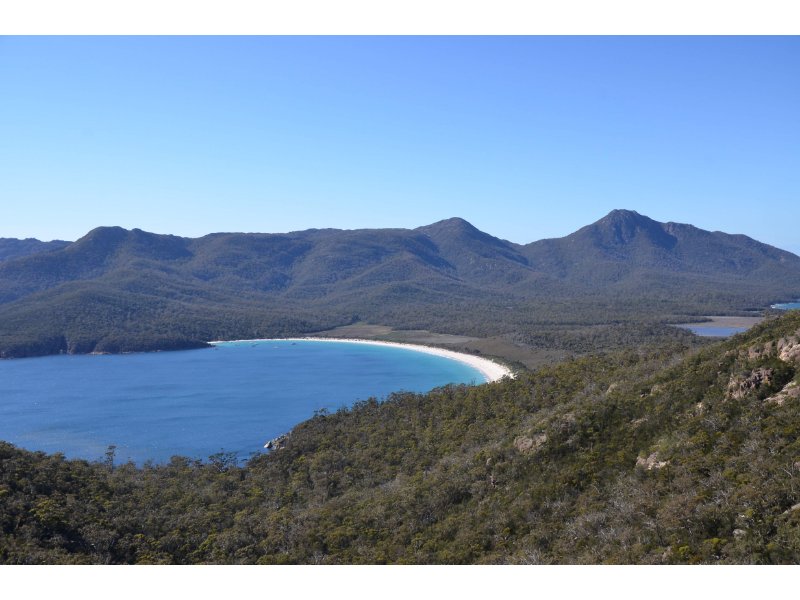
From the opposite end of Wineglass Beach, the trail climbs to the Hazards Saddle. The track is extremely well constructed and the saddle should only take about 1.5 hours to reach from the campsite. A quick sidetrack to the Wineglass Bay lookout is found here. From the lookout it’s approximately 30 minutes walk to the car park to complete the Freycinet circuit.
Planning your Freycinet national park hike
Best time to hike the Freycinet Circuit
The hike can be done anytime of the year, however, summer months of December – April have long daylight hours and warmer temperatures. While East Coast climate is mild in winter, snow can fall on the higher peaks. This is Tasmania and its unpredictable weather.
Water
Water availability on this circuit is scarce, so you need to be prepared to carry sufficient water – another reason to walk during winter when creek water is often more reliable. Walkers are advised to boil water before drinking.
Fees and permits for the Freycinet Circuit
You will need a park permit to enter Freycinet National Park and pay an entrance fee. The price depends if you come by car, visit the park on foot and the duration of your visit. Bookings are not required to do the Freycinet Circuit.
How to get to the Freycinet National Park
Freycinet National Park is 195km from Hobart and roughly 3 hours by car. From Hobart take the Tasman Highway (A3) through Sorell and continue up the East Coast. This highway takes you the majority of the way until you reach the turn off to Coles Bay Road (C302) 12km before Bicheno. Continue for another 20km, passing through the township of Coles Bay to reach Freycinet National Park. The Freycinet Circuit begins from the main carpark.
From Launceston it is a slightly shorter travel time to the Freycinet National Park at just over 2 hours by car. There are also buses available which take around 4.5 hours.
Final Thoughts
The Freycinet National Park Hike circuit is a really pleasant multi day hike that would suit most hikers. The second day is slightly more challenging particularly in hot conditions, however you can take your time.
The beaches and views are certainly very memorable and I imagine hard to beat, anywhere in the world.